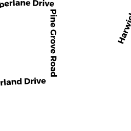
65 TIMBERLANE DRIVE
Owner Information
GODFRIED ALAN &
70 RIDGEVALE ROAD
CHATHAM, MA 02633


Property Details
65 TIMBERLANE DRIVE is classified as a Single Family Residential (Cape).
The primary structure on this property was built in 1974. There are 1,820ft2 of built area within this property. There is 1,820ft2 of residential/living space within this property. This property is listed as having 6 rooms.
65 TIMBERLANE DRIVE is valued at $521,600. The land is valued at $173,900 and the structures are valued at $347,700.
This property is in Zone RM. Confirm with local Zoning Board authorities to ensure there are no overlays or other easements on this property.
The most recent deed for 65 TIMBERLANE DRIVE is recorded at the local registrar in Book 16101, Page 337. 65 TIMBERLANE DRIVE was last sold on Wednesday, December 18, 2002 for $1.
Assessment data from fiscal year 2022.
Flood Data
According to the FEMA National Flood Hazard Layer, this property does not appear to be in a flood zone. It may also be in an area not yet reviewed. Nonetheless, confirm this information prior to taking any action.
To view the flood hazards around this property, create a FEMA "Firmette" Map of the area around 65 TIMBERLANE DRIVE.
Broadband Internet Providers
| Provider | Type | Bandwidth (mbps) | |
|---|---|---|---|
| GCI Communication Corp. | Satellite | 0 | 0 |
| Viasat Inc | Satellite | 35 | 3 |
| Verizon New England Inc. | DSL | 10 | 1 |
| Comcast | Cable | 1000 | 35 |
| T-Mobile | Fixed Wireless | 25 | 3 |
| HughesNet | Satellite | 25 | 3 |
| VSAT Systems, LLC. | Satellite | 2 | 1 |
Broadband service provider data from December 2020.
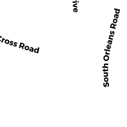
Adjacent Properties
- 75 TIMBERLANE DRIVE
Single Family Residential owned by GAYNOR-RYDER BARBARA AINE - 491 SOUTH ORLEANS ROAD
Single Family Residential owned by JENKINS PAUL & RUTH - 53 TIMBERLANE DRIVE
Single Family Residential owned by ELLIOTT BARBARA A TRUSTEE - 469 SOUTH ORLEANS ROAD
Developable Residential Land owned by JENKINS PAUL E JR TRUSTEE